|
|
|
|
 |
| boating |
|
|
|
|
|
|
|
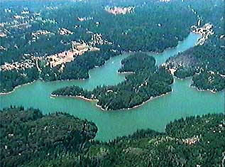
Boating
 Lake, river, or open sea,
there are few "landmarks" on the water.
Lake, river, or open sea,
there are few "landmarks" on the water.
If you know how, and have the time,
the sky can tell you where you are.
Recreational GPS receivers even have some features
which don't make much sense on land, like "man overboard".
Crosstrack error (or course deviation)
isn't much use on a road or trail,
but in the water it can save time and energy,
or keep you from running aground.
Mapping where you go for fishing, diving, skiing,
or swimming is a job well-suited to GPS.
Differential GPS (DGPS) can add accuracy,
as noted later under GPS.
Bathymetric (depth) maps or NOAA navigation charts
can be combined with your GPS data,
hand-drawn maps, or written notes,
resulting in a chart of a SCUBA dive,
reefs to avoid, study or search areas,
or good fishing spots.
|
|
|