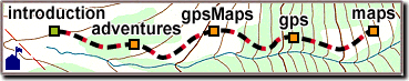
Map Hints
 This chapter is about maps, and how they relate to GPS use.
We'll look at topography, the compass,
mapping, scale, projections, UTM, datum,
and the U.S. Geological Survey.
This chapter is about maps, and how they relate to GPS use.
We'll look at topography, the compass,
mapping, scale, projections, UTM, datum,
and the U.S. Geological Survey.
The sections on UTM
and datum
are especially important when using a GPS receiver with a map.
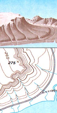
Topography
Topographic maps show the physical features of the land,
usually including "contour lines" of constant elevation.
Contours take some getting used to,
but once you learn "how to look at them",
they add a third dimension to a flat map.
Mountains, plains, ridges and valleys appear,
and they usually match what you see out there.
Smaller features can fall between the contour lines.
One easy source of confusion is which direction is "up",
but there is usually a peak, river, or lake
nearby to cue off of.
Elevations are given for major contour lines.
When there are no landmarks,
the contour of the land is usually easy to read and follow.
|

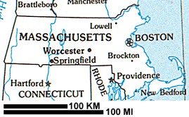 To be useful, maps should be small enough to use, but show good detail.
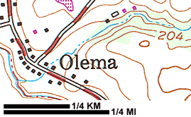 A map covering a small area like a county or town
will have a larger scale (1:24,000).
A map covering a small area like a county or town
will have a larger scale (1:24,000). 
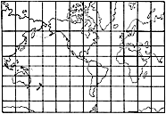 Maps are a flat rendering of the surface of the nearly-spherical Earth.
Projection makes flat maps useful and gives them accuracy,
but there are always compromises.
Maps of the world appear in different projections
to serve different purposes.
Maps are a flat rendering of the surface of the nearly-spherical Earth.
Projection makes flat maps useful and gives them accuracy,
but there are always compromises.
Maps of the world appear in different projections
to serve different purposes. 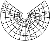 Various Lambert (conic) projections are more uniform in scale,
but parallels and meridians can be curved.
Various Lambert (conic) projections are more uniform in scale,
but parallels and meridians can be curved.