Pigeon Point Lighthouse, CA, USA
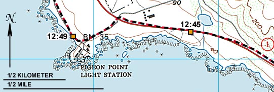
A black & red dotted line shows path and direction of travel from GPS data:
North on route 1,
turning left toward the lighthouse, then continuing North.
The lighthouse picture was taken at 12:45 PM
from the location labeled "12:45" on the map below.
The Coast Guard "benchmark" was photographed at 12:49 PM.
A Wild Rose picMap can show where your pictures were taken.
This one was made with a GPS receiver recording time and location,
while a camcorder took pictures, and also recorded the time.
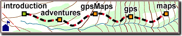
The site map at the bottom of the page
lets you jump to any part of our site,
or you can use "Back" to return.
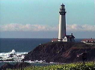 Pigeon Point Lighthouse, CA, USA
 A black & red dotted line shows path and direction of travel from GPS data:
North on route 1,
turning left toward the lighthouse, then continuing North.
A black & red dotted line shows path and direction of travel from GPS data:
North on route 1,
turning left toward the lighthouse, then continuing North.